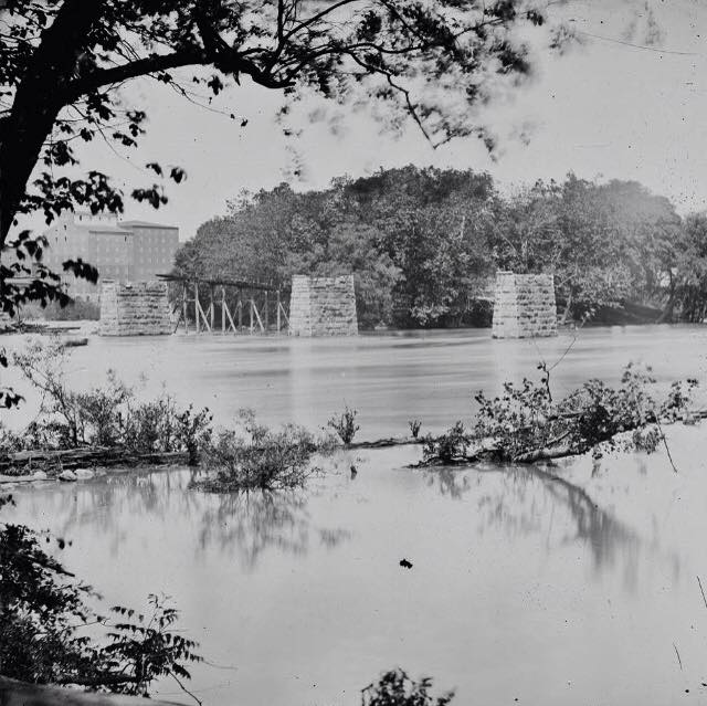
The original Mayo Bridge after a flood (1865)
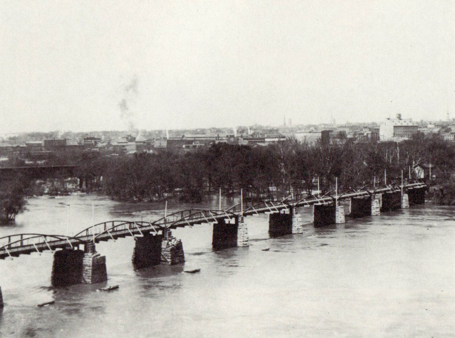
The repaired Mayo Bridge (1889)
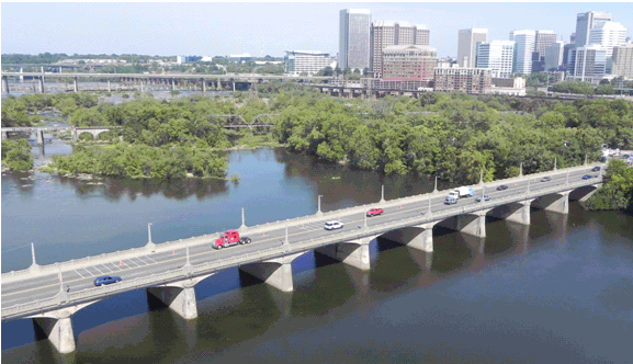
The new Mayo Bridge (2013)
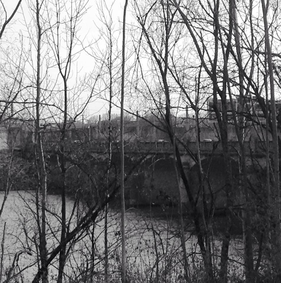
The new Mayo Bridge taken from Mayo Island toward the Shockoe Bottom Side (2015)
Site Name: Mayo Bridge
Date of Construction: Original 1788; Reconstructed in 1913
Reason for Construction: The original Mayo brisge was built for land transportation across the James River. The new bridge was constructed in response to fears of flood danger and to facilitate trade between the North and South sides of the James River.
Site History:The original bridge, built in 1788, was swept away in a flood in 1913. The deteriorating ruins are now over one hundred years old. In 1788, the Mayo Bridge became the first bridge across the James River, opened by Colonel John Mayo as a toll bridge. Colonel Mayo spent so much of his own money repairing the bridge, largely from flood damage, he was ultimately jailed for Debt and bailed out by his good friend, Patrick Henry. Plans for creating a new bridge began in 1904, before the flood, in order for better facilitation of trade between the North and South sides of the river, but also in response to previous flood threats as the new bridge was built “five feet higher than the flood of 1877” (The times dispatch, 1904). It was seen as a necessity for merchants on 14th Street, cut off from trade by the inconvenient toll. The project was funded jointly by Manchester and Richmond at a proposed $250,000 and was laid out by the Concrete Steel Engineering Company of New York as a free bridge. The Bridge was ultimately burned on three separate occasions, in the War of 1812, by the Union Army, and in a fire on Mayo bridge in 1912, none of which were as devastating as flood damage. Today when Richmonders refer to the Mayo Bridge they are generally talking about only the Richmond side of the Mayo Bridge. The Bridge is in two portions, seven spans on the Richmond side and eleven spans on the Manchester side, separated by Mayo’s Island.
Area History: The Mayo family has a long history in Virginia starting with Major William Mayo a surveyor who helped draw the Virginia - North Carolina Line. He also helped Colonel William Byrd lay the grid lines for the city in 1728. In August of 1912, old Mayo buildings on the Mayo Island caught fire destroying landmarks and damaging the almost completed bridge. Manchester began as an important British tobacco port in 1609, but like the Mayo Bridge and much of Richmond, most buildings were engulfed by flames at the end of the Civil War. Manchester to Richmond connections were extremely valuable during Reconstructions after the war as Richmond attempted to rebuild its economy. By 1874, Manchester's population had reached 3,207 citizens and 5,729 citizens by 1880. Flour from Manchester's mills was widely exported, with business from railroads, shipping and manufacturing moving the economy. This new prosperity generated the bulk of development that forms Manchester today. In the late 20th century suburban commercial centers, rather than city commercial centers, were drawing residents and businesses out of the area and further into Chesterfield, along Hull Street.
Site Changes:The Mayo Bridge carries US 360 across the James River, known to most who live in Chesterfield as Hull Street Rd. The current bridge and the original bridge do not lie in exactly the same place and consequently there are ruins downstream in the river that were once the supports for this bridge. The Mayo Bridge rises only 30 feet above the waterline and remains, therefore, Richmond’s only current bridge subject to flooding, however it is now protected by floodgates in Richmond’s flood wall. Today there continues to be a question as to whether the, now over 100-year-old-bridge, will be replaced again. In July of 2012 there was a presentation to the Department of Public Works. In July 2014, the Richmond Riverfront Plan was published, causing delays in the time frame for the replacement of this deteriorating bridge. The bridge will play a crucial role in Richmond’s ability to support the World Cycling Championships which will be held here in September 2015.
Area Changes: Hull Street, today, is a major highway connecting Chesterfield the Southside Richmond, predominantly over the Mayo Bridge. Commercial Centers that continue to pop-up along Hull Street, including shopping centers, movie theaters, and restaurants have contributed to the social and cultural life in Manchester.
Reflection: As an individual, like many individuals who attend Maggie Walker, that finds would like to better connect with Richmond City culture after living my entire life in Chesterfield it is fascinating to find how important this curious landmark was to the connection of Richmond and Chesterfield. I have lived my entire life, effectively, on Hull Street. It is an interesting coincidence that one of my favorite landmarks from visiting Belle Isle and Browns Island also leads home.
Sources:
The times dispatch. (Richmond, Va.), 03 July 1904. Chronicling America: Historic American Newspapers, Library of Congress. <http://chroniclingamerica.loc.gov/lccn/sn85038615/1904-07-03/ed-1/seq-11/>.
The times dispatch. (Richmond, Va.), 15 Jan. 1905. Chronicling America: Historic American Newspapers. Lib. of Congress. <http://chroniclingamerica.loc.gov/lccn/sn85038615/1905-01-15/ed-1/seq-35/>.
"Manchester Historic District." The Gombach Group. Last modified 2007. Accessed March 19, 2015. http://www.livingplaces.com/VA/Independent_Cities/Richmond_City/Manchester_Historic_District.html.
Riggan, Philip. "Mayo Bridge Replacement." Richmond Times Dispatch. Last modified July 6, 2012. Accessed March 19, 2015. http://www.richmond.com/news/local/why-richmond-why/article_054cd923-0696-54a1-b87c-bc51edbe4e92.html.
By Camille V. Yoke
No comments:
Post a Comment